Reykjanes Volcano Guide: Visiting the Sundhnúkur Eruption Sites
Reykjavík: Volcano Eruption Site and Reykjanes Hiking Tour
Duration: category: volcano
Can you visit the Reykjanes volcano in 2026?
The Sundhnúkur volcanic system on the Reykjanes peninsula has been erupting periodically since December 2023. Access to eruption sites depends entirely on current volcanic activity and Icelandic authorities' decisions. Always check Almannavarnir (Civil Protection) before visiting. Never approach an active lava flow without official clearance.
The Reykjanes volcanic system: what has been happening
The Reykjanes peninsula south of Reykjavik has been geologically active for centuries, but the current eruption cycle began in earnest in March 2021 when Fagradalsfjall started erupting after 800 years of dormancy on the peninsula. That eruption ran intermittently through 2021-2022 and produced accessible, relatively calm effusive lava flows that attracted hundreds of thousands of visitors.
| Where | Reykjanes peninsula, ~40-50 km / 40-50 min from Reykjavik |
| Cost | Free self-guided (when open); guided hikes vary by tour |
| Time needed | 2-4hrs for the hike; a full day combined with the Blue Lagoon |
| Check first | Almannavarnir.is and Vedur.is for current access status |
| Best for | Confident hikers with sturdy boots; guided for first-timers |
The Sundhnúkur volcanic system, a different fissure system about 4 km northeast of Grindavik, began erupting in December 2023 and continued producing multiple eruptions through 2024 and into 2025. These eruptions have been more disruptive than the 2021-2022 Fagradalsfjall activity, producing faster-moving lava flows that have threatened and damaged the town of Grindavik and required multiple evacuations.
As of mid-2026, the volcanic system remains episodically active. Eruption sites from earlier in the cycle have cooled and are accessible as hiking destinations during quiet periods. New eruptions can open with hours of warning.
Critical caveat: this guide provides general orientation. Specific access and conditions change constantly. Check Almannavarnir.is (Icelandic Civil Protection) and Vedur.is (Icelandic Met Office) before planning any visit to eruption sites.
Current accessible sites (subject to change)
Fagradalsfjall 2021-2022 lava fields
The original eruption site from the 2021-2022 cycle is fully cooled and has established hiking trails. The hike from Sudurstrandarvegur road (Route 427 area) to the main lava field and cone takes approximately 1.5-2 hours each way on clearly marked trails. The lava surface is rough aa-type basalt — ankle support is essential.
This is the most reliably accessible volcano site and the most established in terms of infrastructure (car park, trail markers). When the Sundhnúkur sites are closed due to activity, Fagradalsfjall remains the primary destination.
Sundhnúkur eruption sites
Multiple fissures opened between Stóra-Skógfell and Hagafell over the 2023-2025 eruption period. The most photogenic and dramatic lava fields from these eruptions are in the Sundhúksgígar crater row area. When access is open, marked hiking routes cover approximately 3-5 km from the road to good viewpoints.
Because some of these sites are close to Grindavik and the Blue Lagoon access roads, their availability has been directly tied to the broader Grindavik situation.
Safety: what you must know before going
Volcanic gases
Sulphur dioxide (SO2) and hydrogen sulphide (H2S) are produced by cooling lava and are hazardous at elevated concentrations. Wind direction matters enormously — standing downwind of even a cooled lava field’s steam vents can expose you to irritant concentrations. Look for warning signs and move upwind if you smell sulphur strongly.
Near an actively erupting fissure, SO2 concentrations can be lethal. Access to these zones is prohibited by authorities for exactly this reason.
Lava surfaces
Fresh aa lava is extremely sharp basalt rubble. Light footwear will be destroyed within the first kilometre. Pahoehoe lava (smoother, ropy-surfaced) is easier but still uneven. You will fall if you are not paying attention. Ankle-high boots are the minimum.
Weather
The Reykjanes peninsula is exposed to North Atlantic winds. A clear Reykjavik morning can mean a 60 km/h gusting hilltop. Bring wind and waterproof layers regardless of the forecast.
Stay on marked trails
Lava crusts can be thin over still-cooling subsurface material. Trails are routed away from unstable ground. Off-trail shortcuts are how visitors get injured or killed at volcanic sites globally. Iceland’s emergency services have had to rescue people who wandered off marked routes.
Guided tours: why they add value here
For volcano visits specifically, guided tours offer more value than for most other Iceland activities. The reasons are practical:
Current conditions: a guide operating these tours daily knows which fissures showed activity that morning, which trails are currently open, and where gas concentrations are highest that day.
Geological explanation: understanding what you are looking at — how lava flows, why lava forms different textures, how the Reykjanes rift system works — dramatically increases the value of the experience. Geology guides make the landscape comprehensible rather than just visually striking.
Safety briefing: a proper guided tour includes instructions on gas hazards, lava surface behaviour, and what to do if conditions change.
The Reykjavik: Volcano Eruption Site and Reykjanes Hiking Tour is a full-day option combining the eruption sites with the broader Reykjanes Geopark landscape.
The Fagradalsfjall volcano hike with a geologist adds expert scientific context and is particularly recommended for visitors with a serious interest in geology or volcanology.
The active volcano hike and Reykjanes Peninsula tour covers the peninsula broadly — useful if this is your primary Reykjanes day.
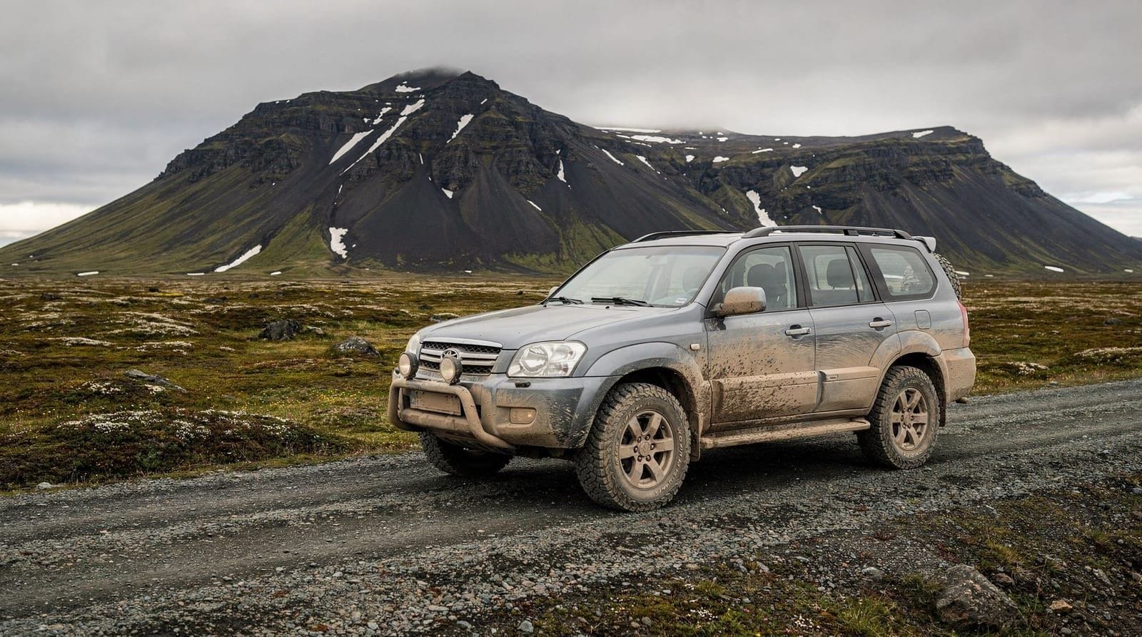
Self-driving to the volcano
For visitors with a rental car who want to explore independently when sites are open:
From Reykjavik, take Route 41 toward Keflavik, then turn south onto Route 427 (Sudurstrandarvegur) toward Grindavik. The Fagradalsfjall trailhead car park is on this road, approximately 40 km from Reykjavik.
GPS navigation is reliable. However, some access roads to Sundhnúkur sites have been periodically closed by emergency barriers — check conditions at the Civil Protection website or call the Civil Protection information line before driving.
The getting around Iceland car vs tours guide provides context on driving independently in Iceland, including road closure procedures.
Combining with other Reykjanes activities
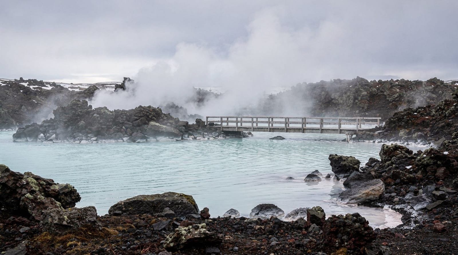
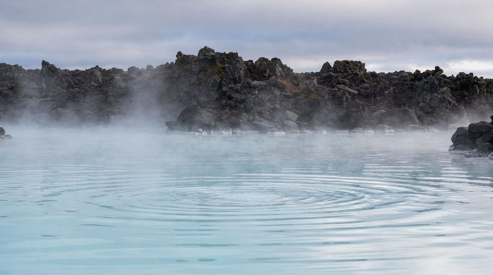
The Reykjanes peninsula offers more than just the volcano sites. The Blue Lagoon destination guide covers the full peninsula.
A logical Reykjanes day might combine:
- Morning: volcano hike (guided or self-guided) 3-4 hours
- Afternoon: Blue Lagoon visit (pre-booked) 2-3 hours
- Evening: return to Reykjavik via Keflavik (or depart directly from KEF if flying)
This pairing is popular and efficient because both sites are on the same peninsula. The Blue Lagoon complete guide covers booking logistics, since pre-booking the Blue Lagoon well in advance is essential.
The Keflavik airport guide is useful if combining a Reykjanes visit with an arrival or departure day.
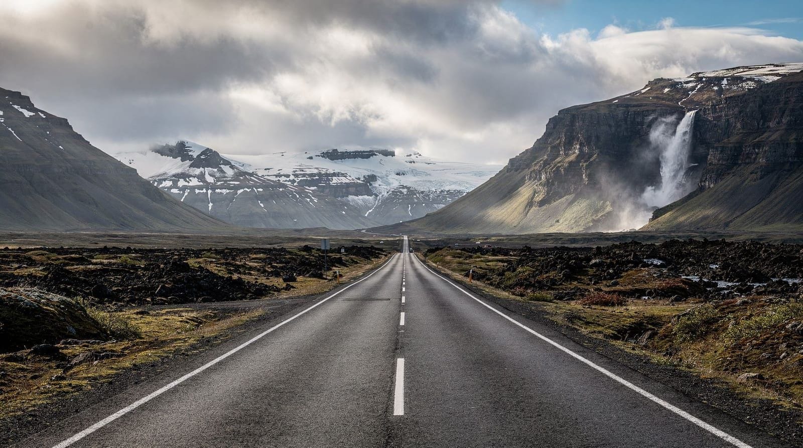
What the lava landscape looks like
First-time visitors are often surprised by how alien and vast a lava field feels at ground level. Satellite images show clear black flows — in person, you are walking through a tumbled landscape of sharp black rock, some fields still faintly warm underfoot, steaming slightly in cool weather.
The contrast between the black lava and any remaining vegetation (moss, grass) is dramatic. Iceland’s sub-Arctic moss recovers lava fields over decades — the youngest lava is stark bare rock, the older fields from 2021 already show first moss colonisation in sheltered spots.
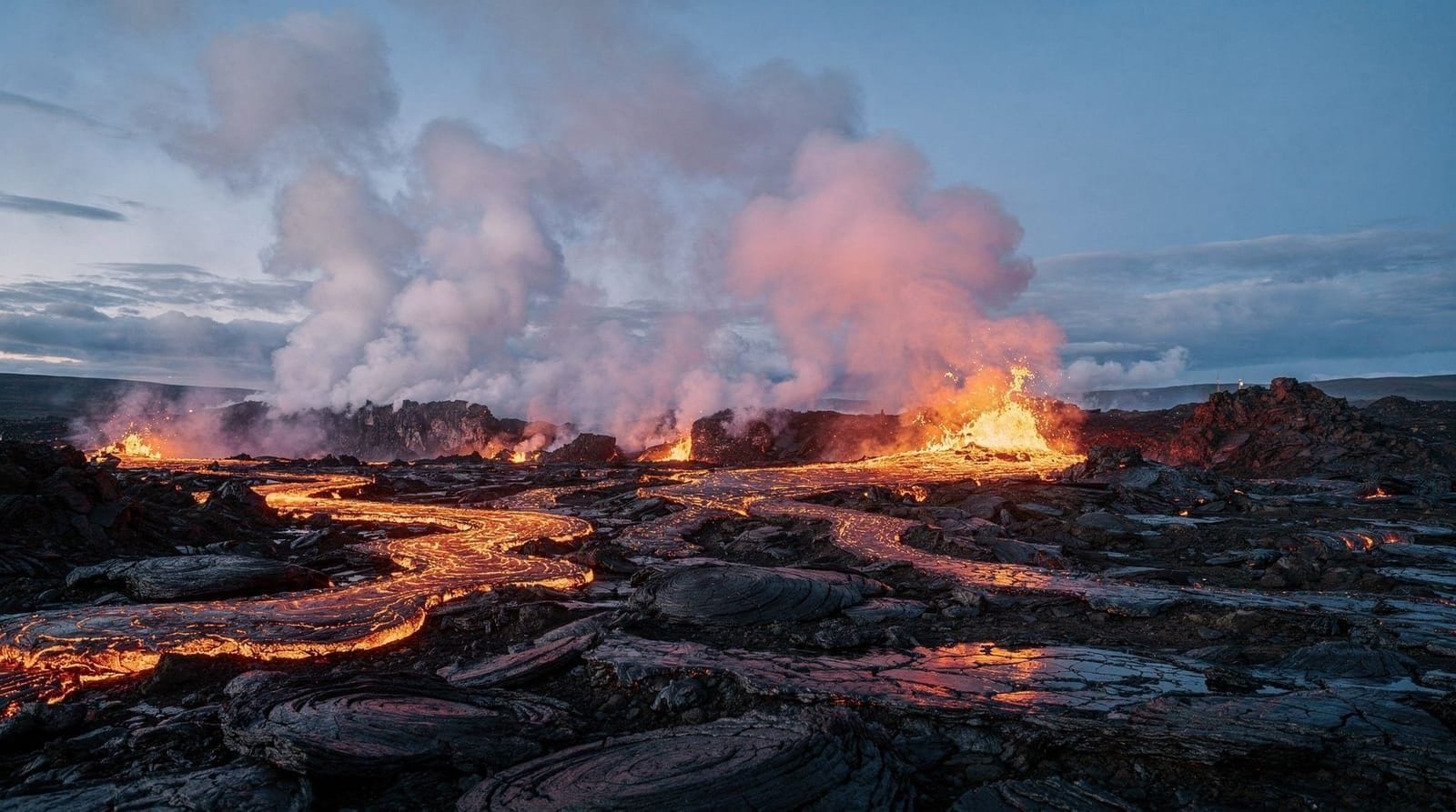
At night, an erupting fissure produces an orange glow visible for kilometres. During the 2021 eruptions, this was visible from Reykjavik on clear nights. If an eruption is actively occurring and authorities have a safe viewing zone open, seeing glowing lava at night is a profoundly memorable experience — nothing else is quite like it.
For a broader picture of Iceland’s geography, the Iceland first-timer guide contextualises the volcanic landscape within Iceland’s overall geology.
The Reykjanes Geopark: beyond the eruption sites
The Reykjanes peninsula is a UNESCO Global Geopark and contains much more than the recent eruption sites. Even when parts of the Sundhnúkur system are restricted, the broader peninsula offers compelling geology and landscapes worth exploring:
Reykjanesviti lighthouse and Valahnúkamol cliffs: Iceland’s oldest lighthouse (built 1878) sits on the southwestern tip of the peninsula above dramatic wave-cut basalt columns and stacks. The area shows active coastal erosion by North Atlantic swell.
Gunnuhver hot spring area: a large active geothermal field with powerful steam vents, boiling mud pots, and fumaroles. Boardwalks lead safely through the area. The smell of sulphur is strong. This is one of the more visually striking geothermal areas accessible without a hike.
Krýsuvik-Seltún: another geothermal field on the northern Reykjanes peninsula, with colourful mineral deposits (yellow sulphur, red iron-rich clay) around boiling mud pools. Less visited than Gunnuhver. The colours are extraordinary in good light.
The Mid-Atlantic Ridge: the Reykjanes peninsula sits directly on the plate boundary between the North American and Eurasian plates. The rift valley that cuts through Thingvellir in the Golden Circle (see the Golden Circle complete guide) extends southwest under the peninsula and continues onto the ocean floor. The visible tension fractures and fissure swarms across the peninsula are the surface expression of this plate separation.
Bridge Between Continents: a small footbridge over a fissure near Keflavik symbolically spans the two tectonic plates. It is a minor attraction but a legitimate geological feature — the fissure is a real expression of the rift.
Planning a full Reykjanes day
The peninsula rewards a full day if you combine elements thoughtfully:
A logical route from Reykjavik: drive Route 41 southwest toward Keflavik, then south on Route 425 to the Gunnuhver geothermal area and the lighthouse. Continue east along the southern coast to the Sundhnúkur/Fagradalsfjall eruption area for a volcano hike (2-3 hours). Finish at the Blue Lagoon, which sits conveniently between the eruption sites and the Route 41 return to Reykjavik.
This circuit is approximately 80-100 km of driving and makes for a long but very full day. For those on a tighter schedule, the eruption hike plus Blue Lagoon alone is more manageable.
The Reykjavik 5-day itinerary and the Iceland 7-day itinerary from Reykjavik both incorporate Reykjanes as a distinct peninsula day.
What genuinely disappoints visitors here
Manage expectations honestly: an eruption that has fully paused shows a cooled, black lava field, not flowing orange rivers — the dramatic photos circulating online are almost always taken during an active eruption window, which is unpredictable and often closed to the public for safety.
Visitors expecting a guaranteed “lava viewing” experience regardless of the current state of activity are frequently disappointed; the honest expectation is a genuinely striking, alien landscape of cooled rock, with the possibility (not certainty) of seeing something more dramatic if an eruption happens to be active and open to viewing during your visit. Checking Almannavarnir.is the morning of your visit, not weeks before, is the only way to know what’s realistic.
Photography on the lava fields
The black rock against grey sky photographs well in flat, overcast light — unlike many landscapes, a lava field does not need golden hour to look striking, since the texture and scale do the work. A wide-angle lens captures the scale of a crater row; a longer lens helps isolate steam vents or colour variation in cooled lava. If an active glow is visible at night, a tripod and a long exposure (10-20 seconds, similar settings to aurora photography) captures the orange light far better than a handheld shot. Always prioritise footing over a shot — lava fields are uneven and unforgiving of distracted walking.
Frequently asked questions about visiting the Reykjanes volcano in Iceland
Is the Reykjanes volcano still active in 2026?
The Sundhnúkur volcanic system has produced multiple eruptions since December 2023, with eruptive periods followed by pauses. Activity is ongoing and episodic. Check Vedur.is and Almannavarnir for the current status before planning a visit.
How do you get to the Reykjanes volcano from Reykjavik?
The Fagradalsfjall and Sundhnúkur eruption sites are roughly 40-50 km from Reykjavik, about 40-50 minutes by car. Guided tours from Reykjavik take 30-45 minutes to reach the trailhead. A rental car gives you flexibility, but some roads near active sites are periodically closed.
Is it safe to visit the Reykjanes volcano?
Visiting dormant or recently-cooled eruption sites with marked trails is generally safe when authorities have opened them to the public. Follow posted signs, stay on marked trails, and never cross barriers. Volcanic gases are a real hazard near active areas.
Do you need a guide to visit the Reykjanes volcano?
For most currently accessible eruption sites, self-guided walking is permitted when the area is open. However, guided tours offer important advantages: guides know current trail conditions and can read changes in volcanic activity. A guided tour is strongly recommended for first-time visitors.
What should you wear to visit a volcano in Iceland?
Sturdy hiking boots with ankle support — lava fields are extremely rough. Layered clothing for wind. A face mask for gas and ash if visiting near active areas. No synthetic fabrics near hot lava. Bring plenty of water.
What happened to Grindavik during the eruptions?
The town of Grindavik was evacuated in November 2023 and has experienced repeated emergency evacuations and some property destruction from lava flows in 2024. Access to Grindavik has varied — check current status before planning to pass through.
Top experiences
Bookable activities with verified prices and instant confirmation on GetYourGuide.